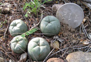
Concerning data on regrowth involving
multiple
pups it is important to understand that there is not necessarily a
direct 1:1 correspondence between sequential figures for individual
pups within a single plant.
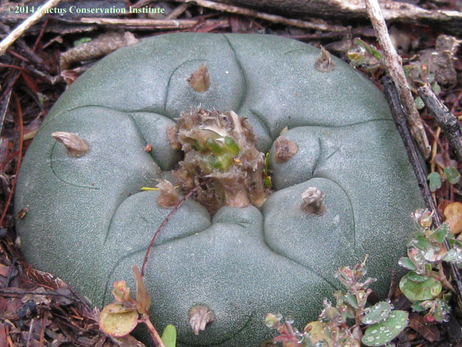
It was not uncommon for some or all pups to be partly or
entirely covered so some photos illustrate the pre-uncovery state.
Images of the tags can be viewed via
the links for the
tag numbers in the first column.
Images of regrowth for the actual
plants that
were harvested in our study can be viewed using the links in the column
headed "Regrowth as number of pups".
Images of the regrowth plants that
were reharvested in the second and third phases of this study can be
viewed using
the links in the comments column.
On 8 March 2010 the second phase of
this study began
with the two year old regrowth of half the original harvested plants
being reharvested. Those twenty plants were rooted for replanting and
the mother plants are now part of a subgroup in the study.
On 13 March 2012 the third phase of
this study began
with the two-year old regrowth of half the reharvested plants being
reharvested yet again (the third harvest of those plants in four
years). The harvested buttons from those twenty plants were dried and
saved for a study to determine the mescaline content of small regrowth
buttons compared to crown tissue from eight-ribbed mature plants from
the same population, and the mother plants are now part of a subgroup
in the study. Both the thrice harvested plants and the
once harvested plants had four dead or missing plants.
The plants being surveyed are part of a
larger
population occurring on private land in South Texas. The area of the
survey site itself is defined with a transect of 17-gauge electric
fence wire secured with steel stakes — the locations of which are
recorded with a high resolution GPS. The transect zigzags through the
study site with all plants in the study being located within
approximately one-half meter of the wire. The area of the study site
has not yet been accurately measured but we estimate it to be around
half a hectare.
7 March 2009 update:
Interestingly we found the same number of
harvested study plants (with their tags) but as can be seen in the
table above these were not entirely the same plants & tags as had
been located on 23 November 2008.
On this visit we used a Trimble
high-resolution GPS instrument to record the location of all tags
and/or plants located.
Complete or partial burial of plants and their
tags was sometimes encountered. To aid in future visits we added a
rebar stake near each tagged plant.
6 March 2010 update:
A number of our tags and plants were completely
buried and hence provided missing data in 2009. In 2010, thanks
to the use of a high powered metal detector, we located our
tags, stakes and plants except in the instances where the plants and
their tag were totally
missing from the study site.
13 March 2012 update:
In 2012, thanks
again to the use of a high powered metal detector, we located all of
our
tags, stakes and plants except as mentioned above. We did not get
photos of control #161 or its
tag again this year.
10 March 2014 update:
In 2014, we
had the interesting challenge of photographing and measuring plants
amidst rain. We did not locate #111's
tag or rebar this year.
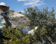
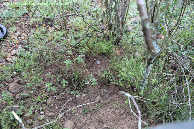
View of the beginning of our transect line
& the
former locations of plants #101 & #102.
If you would like to help
support additional
studies of this type, designed to answer basic questions that are
critical to the optimal stewardship/management of vulnerable cactus
species, please send a contribution,
of $25 USD or whatever amount you can afford, to the Cactus
Conservation Institute, 909 E. Sul Ross Ave., Alpine, TX 79830.
We also now accept donations via PayPal.